Friday, September 30, 2011

OMG, it's Lake Umbagog!!!


Umbagog Lake is a wilderness lake located in Coös County, New Hampshire and Oxford County, Maine, considered to be one of the most pristine lakes in the state. It lies in the towns of Errol, New Hampshire, and Upton, Maine, as well as the townships of Cambridge, New Hampshire and Magalloway Plantation, Maine. The name Umbagog is pronounced with the stress on the second syllable (um-BAY-gog) from the Abenaki word for "shallow water".


We camp at Lake Umbagog for two weeks in late September.  The sunsets are spectacularly stunning.  The night sky, with no light interference, is an inky, dark sky, making the Milky Way loom large and prominent!   Every day, the foliage turns up the intensity of color another notch, until finally when we depart,  it is at its vibrant, flaming peak!


Following the Androscoggin River into nearby Errol is a lovely scene, winding lazily at times along the road, and at other times crashing over boulders with white water spray galore.


Fly fishermen are always present in their waders or in little row boats.


We are on a constant lookout for moose, but none to be seen.


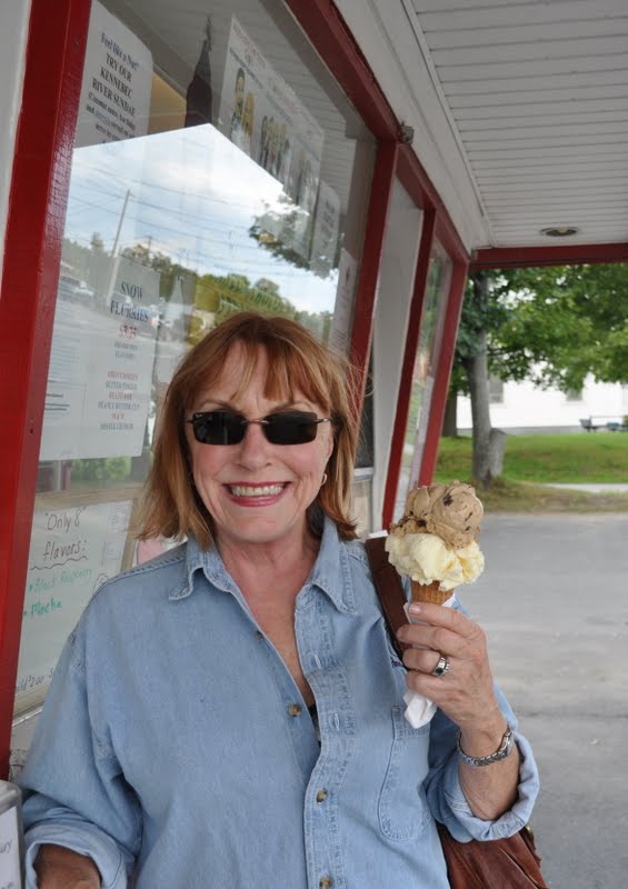
In Errol, we are ecstatic to find L.L.Cote's Toys for Big Boys and Girls store.


We set our sights and hearts and minds on two Old Town Dirigio 10 1/2 foot kayaks, 'cloud' for me, 'sunrise' for Mike AND with matching paddles, no less!


Austin, our salesman, is knowledgable and ever so helpful as he assists us in selecting the best equipment for our needs.


We love, love, love our kayaks!  Our first two ventures are beautiful experiences.  On our third foray; however, as we near the middle of the lake, the wind picks up and the waves start approaching the intensity of white caps.  Novice that I am, I struggle to get across the lake, only to round a bend too close to shore, winding up on a big flat rock just below the surface that I can't get off of.


After the panic subsides, I make it around the bend, but lesson learned.  I am not ready for windy kayaking!


The Presidential Range is a mountain range located in the White Mountains of the New Hampshire, almost entirely in Coos County, and with the highest peaks of the Whites.  Its most impressive summits are named for American Presidents, followed by prominent public figures of the 18th and 19th centuries.


Mt. Washington, long home of the highest winds recorded on the surface of the Earth at 231 mph is the tallest at 6,288 feet.  In the museum, they have a movie playing called the 'Breakfast of Champions' to illustrate just how windy it can get atop Mt. Washington!  A fellow goes to the restaurant there, asks to be seated outside.  The waiter tells him it is a bit breezy today, but he insists.  The gale force winds make for a hilarious dining experience.  First the cereal blows literally out of the box, his clothes are plastered against his skin and when he tries to pour milk over the cereal it is blown in every direction.  I was laughing so hard I almost embarrassed myself, but not quite!  When he finally gets blown over, and the chair and table get whisked away...haha, very funny stuff!  Take my word, it gets windy up there!


The peaks are named chiefly for U.S. presidents, with the tallest mountain, Mt. Washington, named for the first president, the second tallest , Mt. Adams, for the second president, and so on. However, due to a surveying error, Mt. Monroe is actually 22 feet taller than Mt. Madison, which is not the correct order of presidents, oops!


Mount Washington's Auto Road is not for the faint of heart.   The road, constructed in 1861, climbs about 4,700 vertical feet at an average grade of 12%.


The first 4 miles are cut through dense forests of hardwoods and evergreens.


At around 4,500 feet, the trees are stunted, twisted, and gnarled.  As you climb above the tree line, the road at times appears to disappear into the sky.


Sheer drop-offs with no guard rails just about send my vertigo into overdrive.  I consider curling up in the fetal position on the floorboard of the truck more than once.  While Mike, pleased as punch, and in his element of enjoying extreme adventures, (he used to skydive for goodness sakes!), just putters along to the top with a big grin on his face, as relaxed as can be! I on the other hand am on the verge of a panic attack or hurling at the very least!


The views are indeed spectacular, even though the summit is enveloped in a cloud, which it is 60% of the time.


In the mid-19th century, the summit was developed into one of the first tourist destinations in the nation, with construction of more bridle paths and two hotels. The Summit House opened in 1852, a 64-foot-long stone hotel anchored by four heavy chains over its roof.


 In 1853, The Tip-Top House was erected to compete. Rebuilt of wood with 91-rooms in 1872-1873, The Summit House burned in 1908, then was replaced in granite in 1915.  The Tip-Top House survived the fire and today  is a state historic site, recently renovated for exhibits. Other Victorian era tourist attractions included a coach road (1861)—now the Mount Washington Auto Road—


and the Mount Washington Cog Railway (1869), both of which are still in operation.


Spending two weeks soaking up the metamorphosis that is the seasonal change we call autumn


is such a treat for us since Florida has two seasons, sort of.


We discover the quaint village of Stark, who according to its native son, our favorite kayak guru, Austin, has the most photographed covered bridge in New England.


In Lancaster, we espy this beauty.


But the most surreal covered bridge experience was in Groveton, where we found this jaw-dropping, mirror image wonder!


It is always a special treat when fellow Airstreamers are camping nearby.  We enjoy meeting Paul and Jane from Connecticut in their 1959 International Bat Cave Express.


They have lovingly restored it, making it eclectic, funky and fun!  


The pristine remoteness of Lake Umbagog is relaxing and invigorating.  Sunrises, sunsets, the lake, the foliage, the night sky, and campfires.  No TV or phone signal for two whole weeks...ah, heaven!

Wednesday, September 14, 2011

Vieux-Québec


Québec City,  the capital of the Canadian province of Quebec, is situated  on a high bluff where the narrowing of the Saint Lawrence River begins.


Cap-Diamant (Cape Diamond), and Lévis, on the opposite bank, provided the name given to the city, Kébec, an Algonquin word meaning "where the river narrows".


Founded in 1608 by Samuel de Champlain, Quebec City is one of the oldest cities in North America.


The ramparts surrounding Old Quebec (Vieux-Québec) are the only remaining fortified city walls that still exist in the Americas north of Mexico, and were declared a World Heritage Site by UNESCO in 1985 as the 'Historic District of Old Québec'.


The city is a major cultural centre of the French-speaking world, as well as an important tourist destination. Various festivals are held annually including the Summer Festival, and Winter Carnival.


The city's most famous landmark is the Château Frontenac, a hotel which dominates the skyline.


The National Assembly of Quebec, the Musée national des beaux-arts du Québec (National Gallery of Quebec), and the Musée de la civilisation (Museum of Civilization) are found within or near Vieux-Québec.  A spectacular exhibit on Rome is at the museum until the end of the year.  The artifacts on display are wonderful representations of that most ancient of cities.


Quebec City has many, many miles of bike trails and we spend two days riding our trikes on them.  One day on the north shore of the St. Lawrence all the way into the city, a roundtrip of ten miles.


On another sunshiny day, we make a twelve-mile roundtrip into the city of Levis, on the southern shore of the river.


We enjoy that ride more because there are fewer hills and the view of Quebec City is so fabulous!


Hearing French being spoken, reading all of the signage in French, and the European architecture make us feel that we have been transformed magically to France.   Its quaint ambiance charms us completely!

Monday, September 5, 2011

How Now Brown Skowhegan???


We arrive in Skowhegan, Maine,  just in time to hunker down for Hurricane Irene.  In preparation, we stow all outdoor awnings, lawn chairs and the grill.  Then we fill up all of the holding tanks for ballast.  I'm of the opinion that we should head further inland, to the northwest, but Mike assures me we will be fine.  Irene arrives all tuckered out and Vermont gets the worst of it.  Glad we stayed put, Mike was right-e-o on this call!


It is my 64th birthday, and we decide to spend a leisurely afternoon in nearby Skowhegan, the county seat of Somerset County, Maine, with a population of around 10,000.


The Old Mill Pub is our choice for lunch, with its spectacular views of Skowhegan Island and Falls.


The Skowhegan Falls (which have since been replaced by the Weston Dam) descend 28 feet over a half mile on the Kennebec River, which is raging and up at least five feet due to Irene.


This was once territory of the Norridgewock tribe of Abenaki Indians, whose village was located in Madison until 1724, when it was sacked during Dummer's War. From spring until fall the tribe fished here, where abundant salmon and other species could be caught by wading. Consequently, they named the area Skowhegan, meaning "watching place [for fish]."  Colonel Benedict Arnold and his troops passed through the village in 1775 on their way to the ill-fated Battle of Quebec.


Skowhegan Falls provided water power for industry, and as a result, Skowhegan developed into a mill town. Numerous mills were built on Skowhegan Island, which separates the river into north and south channels. In the 19th-century, the town had a paper mill, sawmill, two sash and blind factories, two flour mills, a wood pulp mill, three planing mills, a woolen mill, an oil cloth factory, two axe factories, a scythe factory, two harness and saddlery factories, a shoe factory and a foundry.


Skowhegan boasts that they once had a factory that made most of the world's popsicle sticks.  Like so many other companies, the business went to China.  A few years later, after many complaints about splintering, (ouch!), defective Chinese popsicle sticks, there was an effort to bring the business back to Skowhegan.  To date, that has not happened, but we can hope!  In 1986, the S. D. Warren Company, a division of Scott Paper Company, opened a plant in Skowhegan. In 1997, the S. D. Warren mill was sold to Sappi Fine Paper.


The New Balance Athletic Shoe Company operates a factory in the community, employeeing around 700.  We both buy new sneakers at the New Balance Factory Store housed in an old Catholic school which was built in 1880.  Lovely old building!


The Swinging Bridge is a suspension footbridge first constructed in 1883 to connect Skowhegan Island with the south side of the Kennebec River.  We have fun bouncing up and down on it as we walk back and forth across it.


Just over the bridge we come upon an ice cream shop so we decide to have a birthday treat, in honor of MY day!  I opt for Kahlua cappuccino & coconut, while Mike partakes of pure coffee all the way, such a purist!  The ice cream shop will be closing in a few days for the winter, and will reopen next spring, so good timing on our part!


On the north side of the municipal parking lot stands a 62-foot-tall sculpture depicting an Abenaki Indian, carved by Bernard Langlais.

In 2003, Skowhegan was a major filming location for an HBO movie based on the 2001 book, 'Empire Falls', by Richard Russo and starring Ed Harris and Paul Newman.


In nearby Madison, located amongst stately pines and white birch on the western shore of Wesserunsett Lake, we find Lakewood, the State Theater of Maine and one of America's oldest and most famous summer theaters.   It is a short drive from Skowhegan, so in celebration of my Birthday Month, we decide that dinner and the theater are just the ticket.

First we decide to have dinner at the Lakewood Inn Restaurant.  We are seated at a table with a lovely view of Lake Wesserunsett.  The building had fallen into disrepair in the 80's & 90's, but is now restored to a kind of 40's splendor and serving fine dinner offerings before the curtain goes up in the theater across the road.

'Now in its 111th Season, Lakewood offers exceptional performances of comedies, dramas, musicals, and children's shows from late-May through mid-September.'

'In its glory days, Lakewood Theater saw the likes of Gloria Swanson, Vincent Price, Lynn Redgrave, Milton Berle, Lana Turner, Robert Preston, Phyllis Diller, Maureen O'Sullivan, Imogene Coca and more. Dressing room walls, which sport some of their fading signatures, notably John Travolta's and Myrna Loy's have been preserved. Actors would stay in cottages by the lake for a week as that's how long each show ran. On their last night at Lakewood, they'd be treated to a lobster feed.'


Tonight's play is 'The Red Velvet Cake War', a laugh-out loud comedy featuring the Verdeen family cousins in Sweetgum, Texas, as they prepare for a family reunion.   Nervous breakdowns, romance, and hilarity....It is an 'uproarious Southern-fried comedy by Tarheel comic dramatists Jessie Jones, Nicholas Hope, and Jamie Wooten, is a real knee-slapper.'  The cast is superb!  Don't miss this play if you ever have a chance to see it!

Bangor is a short drive to the east, so we decide to go see 'The Help' one afternoon, you guessed it, for my Birthday Month!  I read the book last year and loved it!  Turns out the movie was fabulous with Mike approving heartily of it!


On the way to the theater, we swing by #47 West Broadway to take a gander at Steven King's house!


Its  gothic turrets and wrought iron fence replete with spiders and spider webs, bats and 2-headed dragons do not disappoint us.  Unfortunately, Mr. King is nowhere in sight!


The Birthday Month winds down to a glorious end...it was a good one!